


Introduction
With the arrival of GIS, hand-drawn maps and centimeter-accurate 3D models have been replaced. The industry will go to the next level when telecommunication networks will be integrated into a GIS. In this blog, I will tell you the importance of GIS in the Telecom Industry. I hope by the end of this blog you will have a better understanding of it.
Migrating to the GIS Platform
Your collection of old maps may contain important information that GIS Map Editor may convert into a functioning asset and records-keeping system.
The crucial qualities that give the data depth can be preserved while migrating the assets into a spatial environment. Your operations will be more efficient, and your clients will be impressed if you completely replace your static paper maps with a GIS-based solution.
Building New Assets
Infrastructure and utilities like telecommunication, water distribution systems, and roads can be diligently mapped entirely in the construction process, in a GIS system. You can build new assets proposed in your system in no time in the map editor.
The simpler way is to display the same data but show the “Proposed” vs “Active” property. Existing facilities may be considered “active” while classifying them as “proposed” or “planned”.
Throughout the asset’s life, all this data can be mapped. commencing with the planning stages through construction and as-built approval phase. To confirm that the feature is mapped with high precision after the building phase, the finished asset can be checked using an external GPS unit connected to a GIS mobile data collection app..
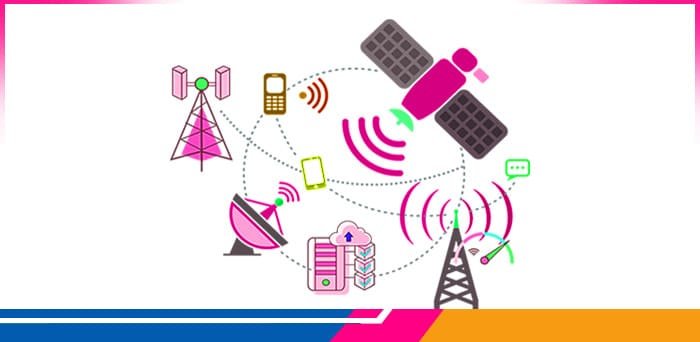
GIS application – Telecommunication
Attach onsite live photos to the application for the perspective of the current situation. Your routine maintenance program will be more effective and complete with a maintenance log on the GIS platform environment. You can map address locations via Geocoder, it maps the data and takes a table of addresses.
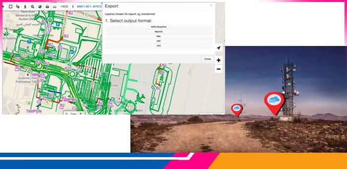
Once the mapping is done, locations can be exported to numerous data types such as CSV, MapInfo, DXF, KML, shapefiles, etc.
Here are some Scenarios from which you can respond to the public at the time of disasters:
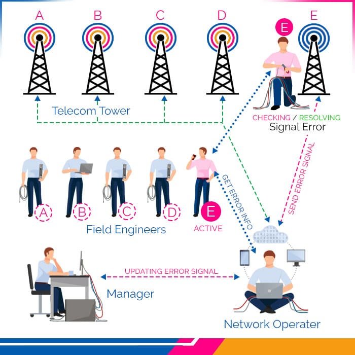
Millions of people may be affected by disasters that strike with little or no warning. You can tell the public about important information on the state of your network by using the Public GIS Cloud Portal.
You may model the impact of a single shutdown or the potential for a downline on the network in a GIS environment. These simulated scenarios can help you and your team to identify the most important areas for improvement.
These mock network failures can respond to queries like:
- How many clients might be affected?
- What would be a reasonable response time for us?
- Are there any backup redundancies in place?
- Where should we focus our resources to reduce potential future outages?
Conclusion
In conclusion, Telecommunications depends on spatial information to give service to its customers and it’s a reliable operation too. GIS’s multiple tools and applications can be a powerful facilitator for a telecommunications service provider.
At Copperchips, we provide solutions consultancy that can guide you and your team no matter where you are in GIS adoption. Our solutions include mobile applications, public portals, and custom reports that will help you to grow in a GIS world.